
We are currently having technical problems affecting our telephones and some online services. We are working hard to have everything working as soon as possible
Explore coastal erosion risk for anywhere in England

Date published: 17th April 2026
In early 2025, the Environment Agency released new data and modelling projections of coastal erosion risk for the coast of England.
This information is online and available to anybody to explore. You can access it here - Check coastal erosion risk for an area in England - GOV.UK
The online tool uses the most up-to-date coastal monitoring data, research and modelling currently available. As well as geology and information about local coastal processes, the online tool takes into account global and national scenarios of climate change (sea level rise) and Shoreline Management Plan (SMP) policies.
Why is this information important?
The information is freely available and intended to help people, including those who may be thinking of buying a home in a coastal area, to assess the possible risk of coastal erosion over time so that they can make an informed decision. The policies and modelling also inform local authority coastal managers about what is at risk and the rate of change, so that plans can gradually be developed to prepare for this change.
It is important to remember that any modelling or projections about future coastal erosion involve inherent uncertainty. There are many reasons why things may happen a bit differently, for example, more quickly or slower than expected. By selecting different parameters, users can explore the impact of different shoreline management policy choices or climate change scenarios on coastal erosion in the future.
What timeframe does this cover?
Having robust information about how change is likely to manifest over the coming century (to around 2055 and 2105) helps us better understand what is at risk of coastal erosion, assess the impacts of this risk, and prepare and plan ahead. This is the focus of the Coastwise project, which is working with coastal communities between Weybourne and Cart Gap in North Norfolk to prepare for coastal change. The project is also generating nationally transferable learning to benefit other places.
Where can I find this information?
The online tool enables a user to explore the Shoreline Management Policy and coastal erosion risk (where there are coastal cliffs) for any section of coast in England. For coastal flood risk (and other types of flood risk), visit - Check the long term flood risk for an area in England - GOV.UK
How do I use the online tool?
Scroll down through this step-by-step explainer to help you generate and explore projections of coastal erosion risk for a location(s) of your choice.
Step-by-Step Guide
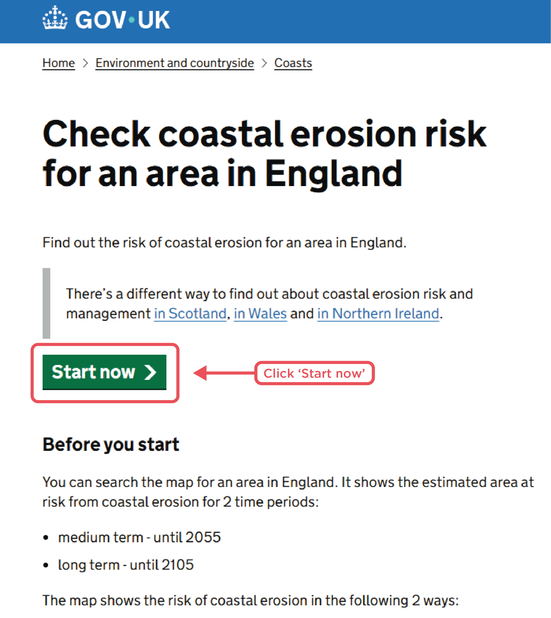
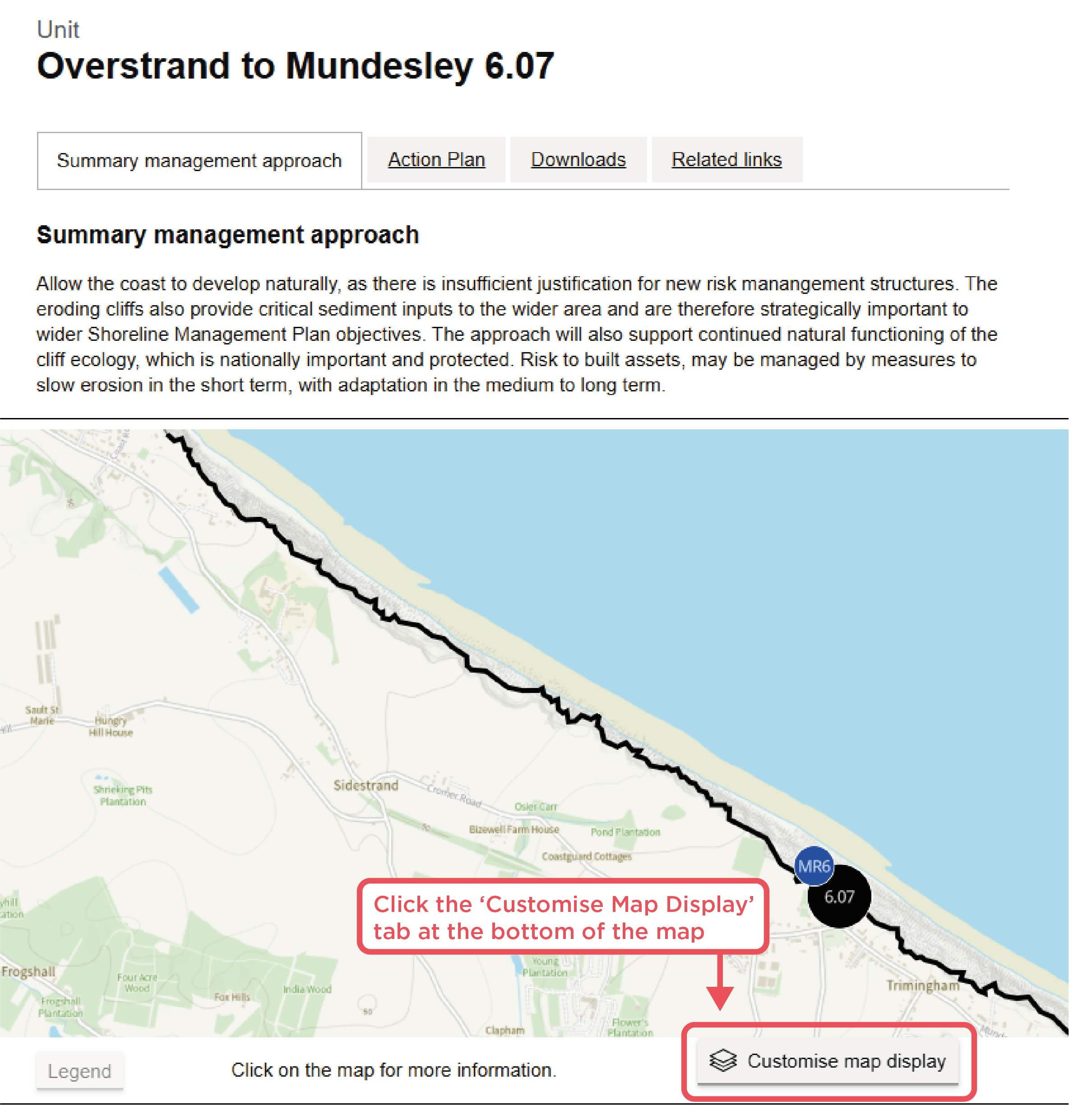
Visit this webpage (Check coastal erosion risk for an area in England - GOV.UK) to check the Shoreline Management Plan Policy and coastal erosion risk for an area you want to know about.
To find the Shoreline Management Plan Policy and associated information for a particular location:
1) Click 'Start Now'
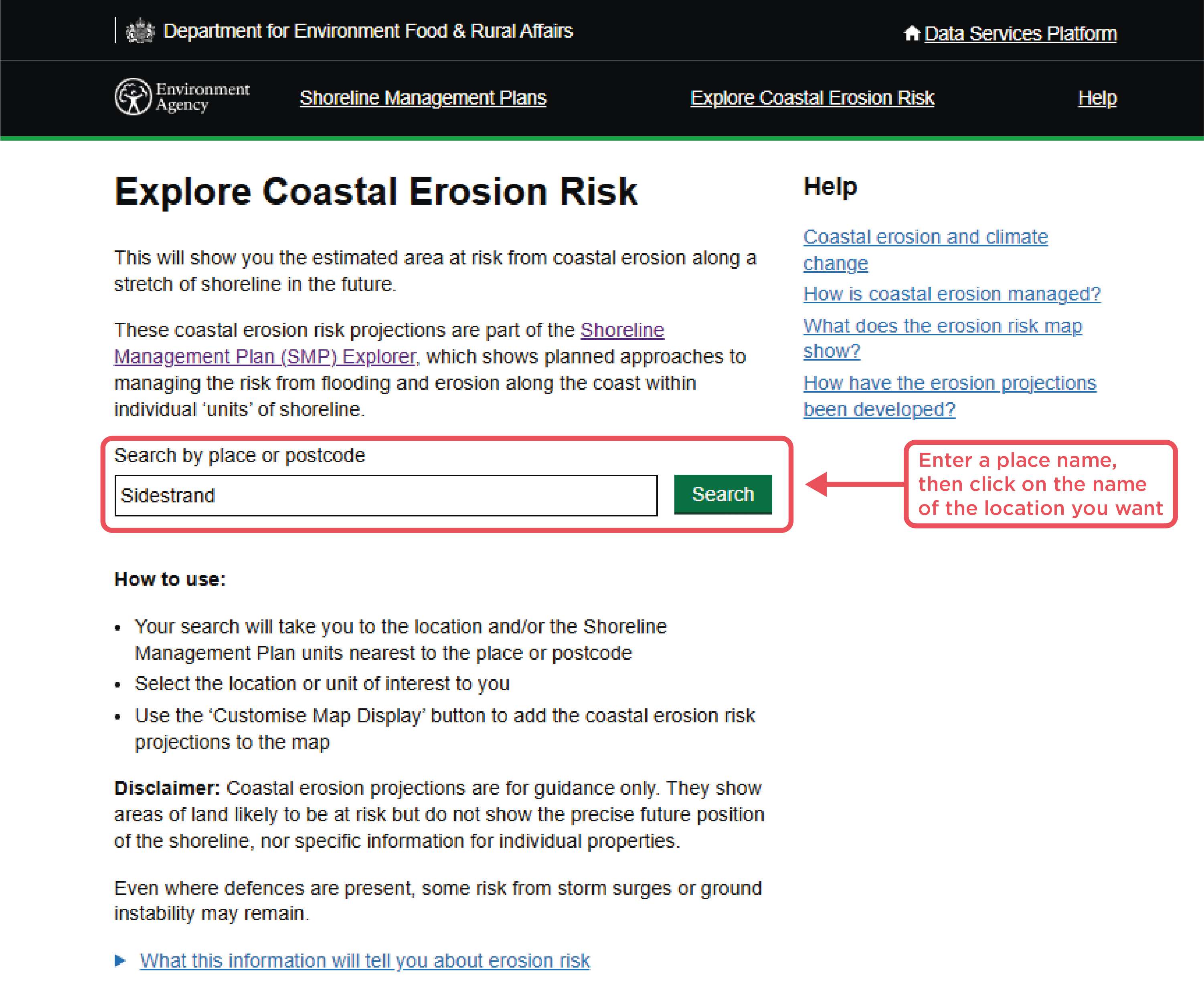
2) Enter a place name, then click on the name of the location you want
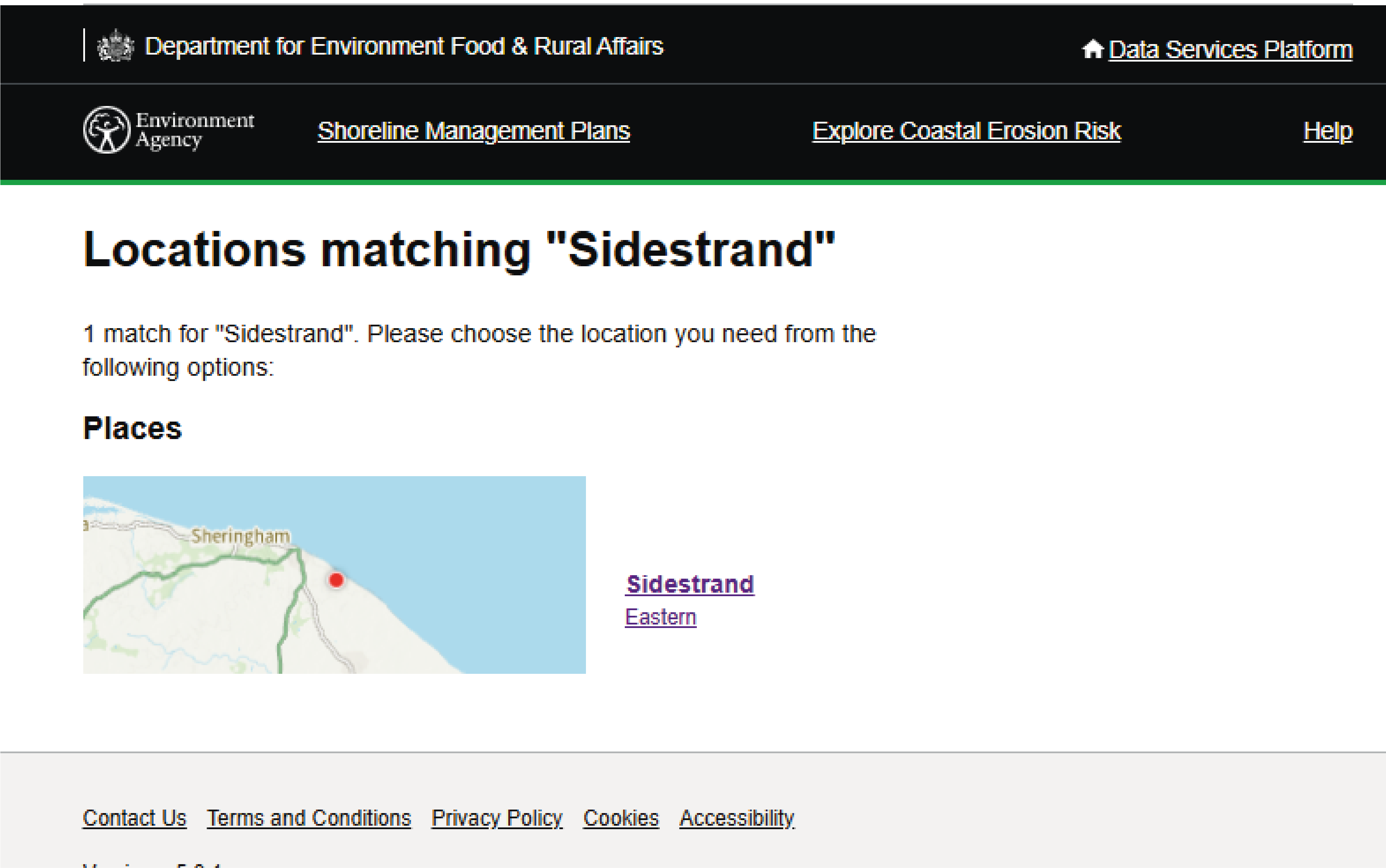
3) Select the specific section of the map (policy unit) you are interested in
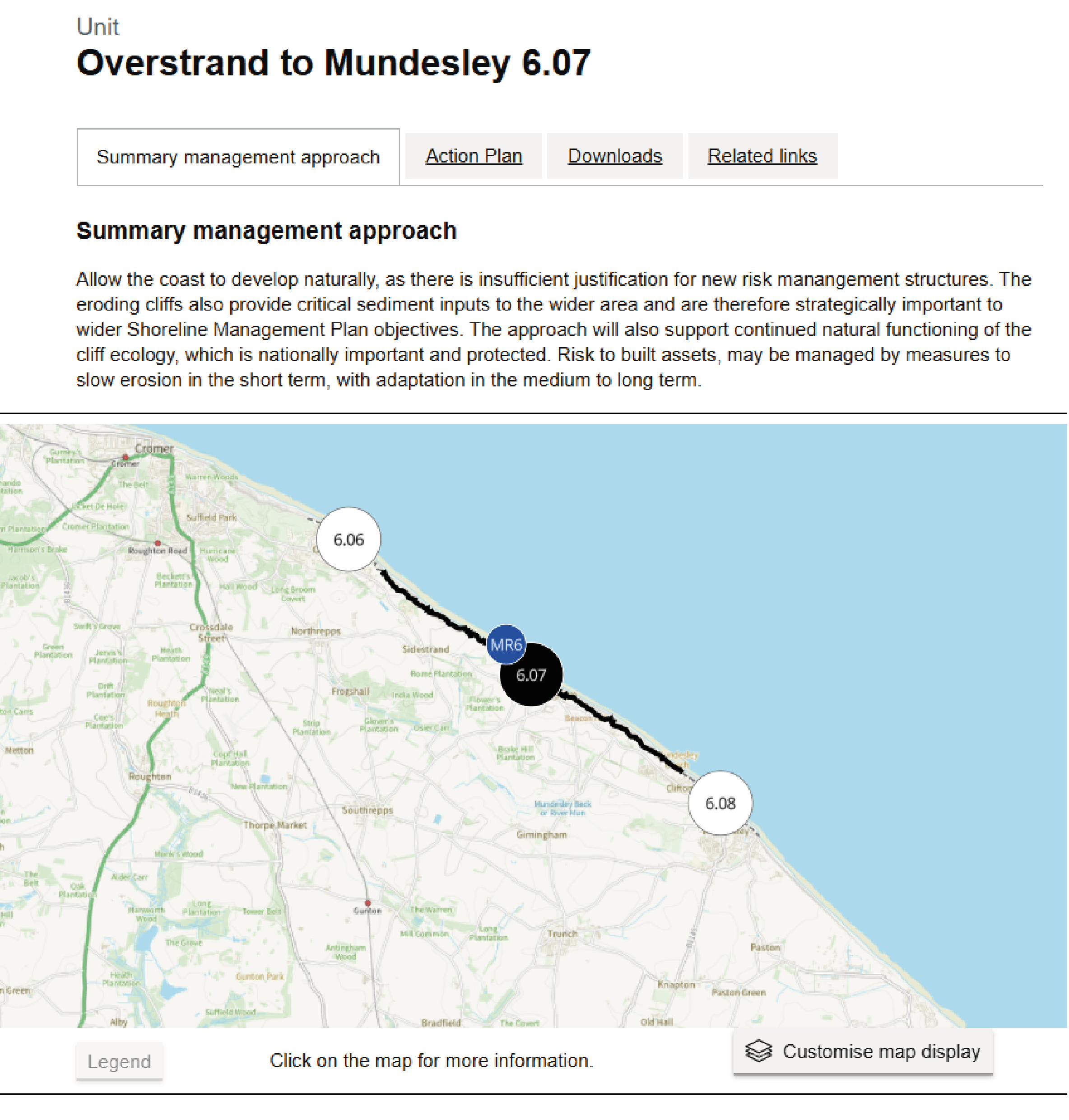
4) Browse the policy details for this coastal unit. Scroll down the page for more details.
Shoreline Management Plans have existed for some time – 2025 was the end of the ‘first epoch’.
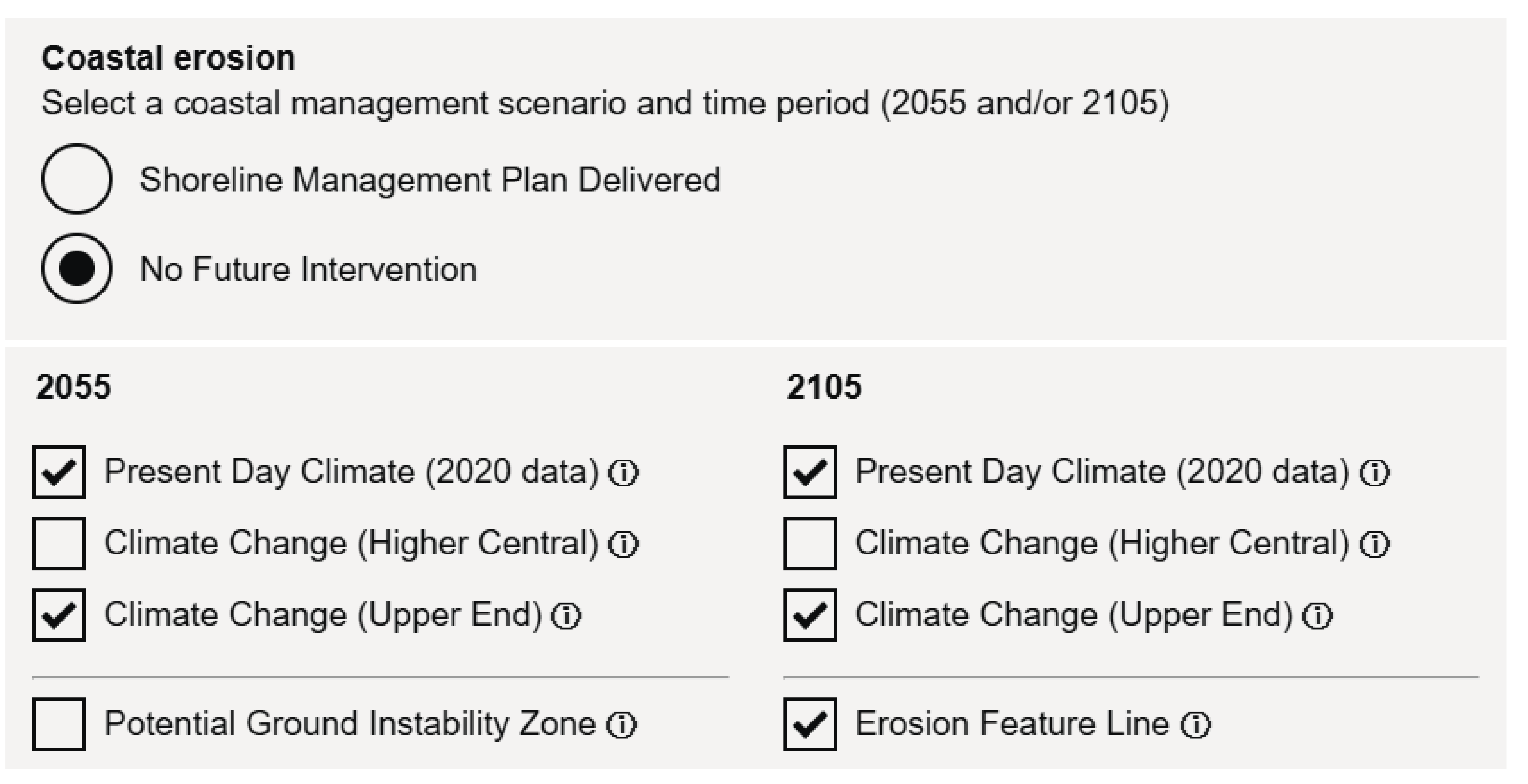
To explore coastal erosion risk under different policy and climate change conditions:
5) Click the 'Customise Map Display' tab at the bottom of the map
6) This panel enables you to select the parameters you are interested in exploring.
You can explore different:
- SMP Management approaches
- Timescales (currently 2055 and 2105)
- Climate change scenarios (higher central and upper end)
The information buttons give additional explanation.
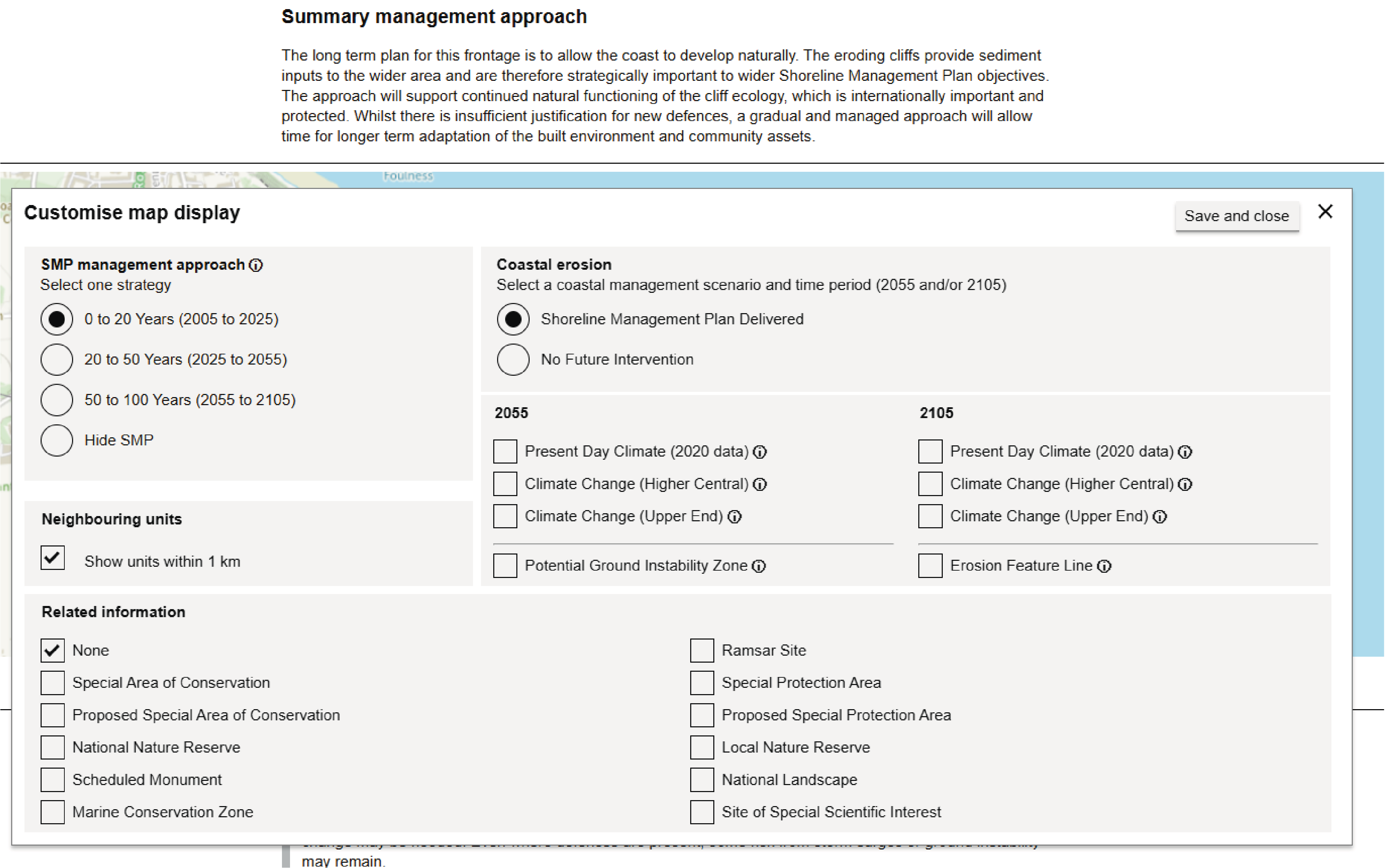
7) After you have selected the combination of system drivers you want to look at, click ‘Save and close’. You will see a map showing the projected coastal erosion impacts for the parameters you have selected.
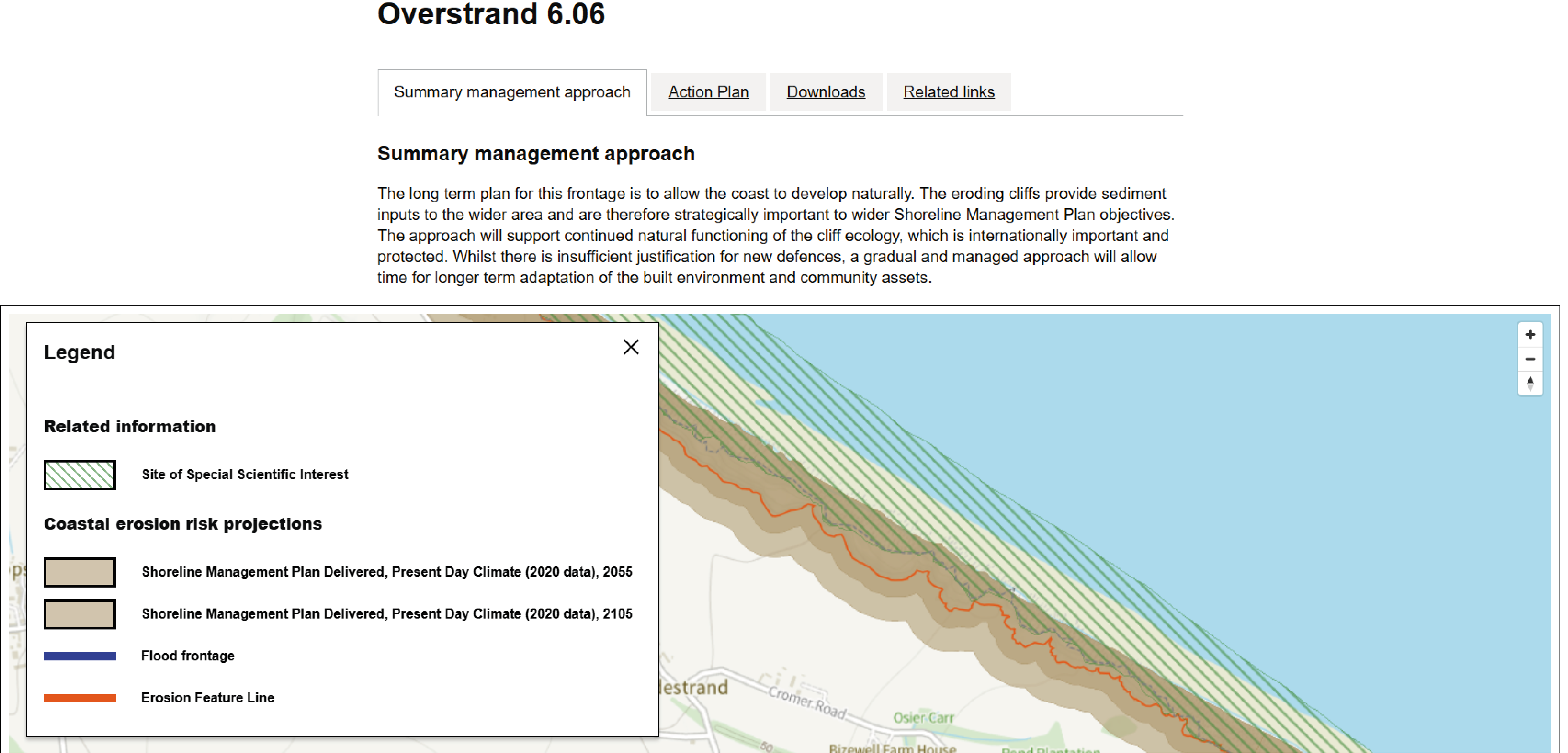
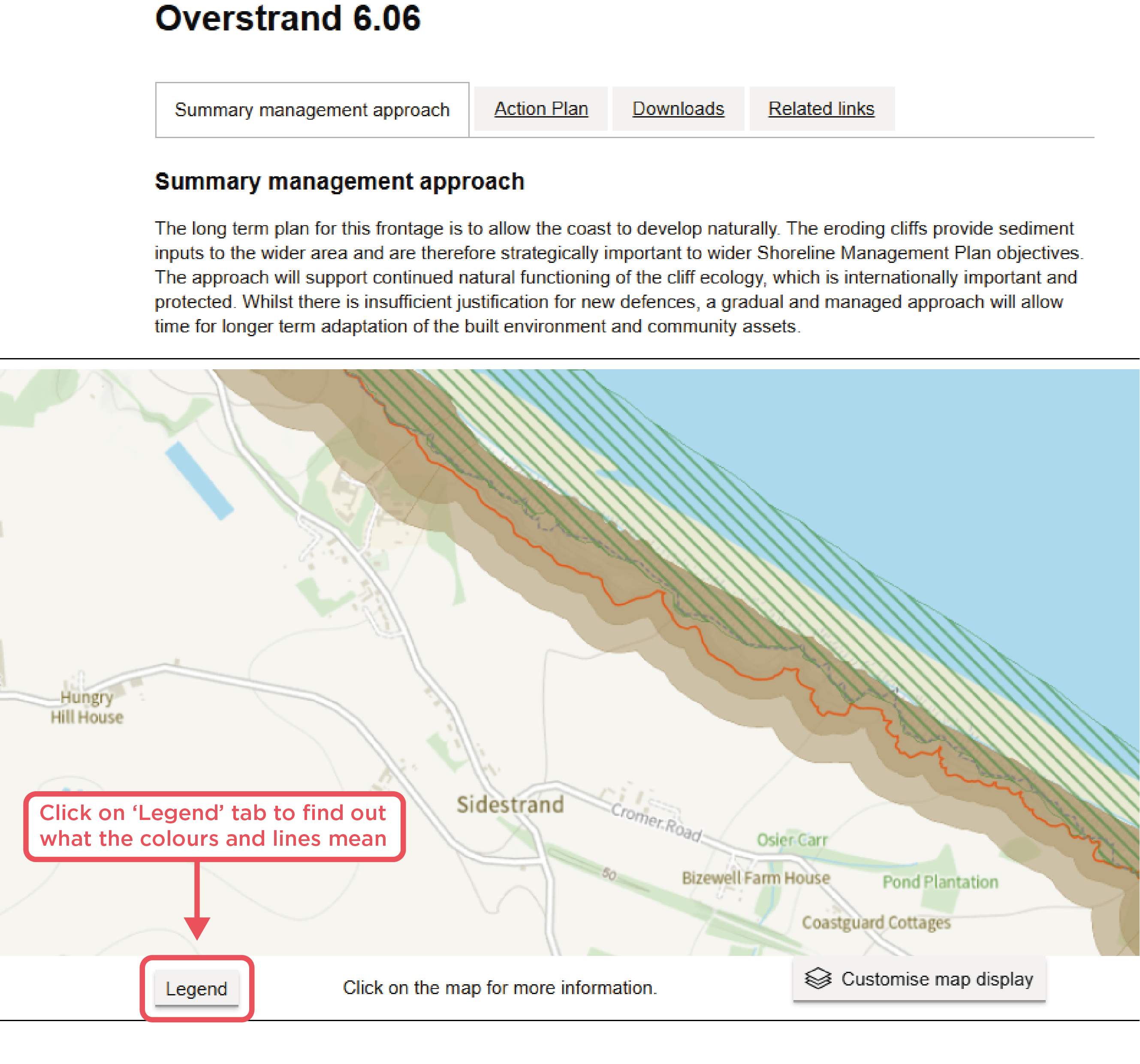
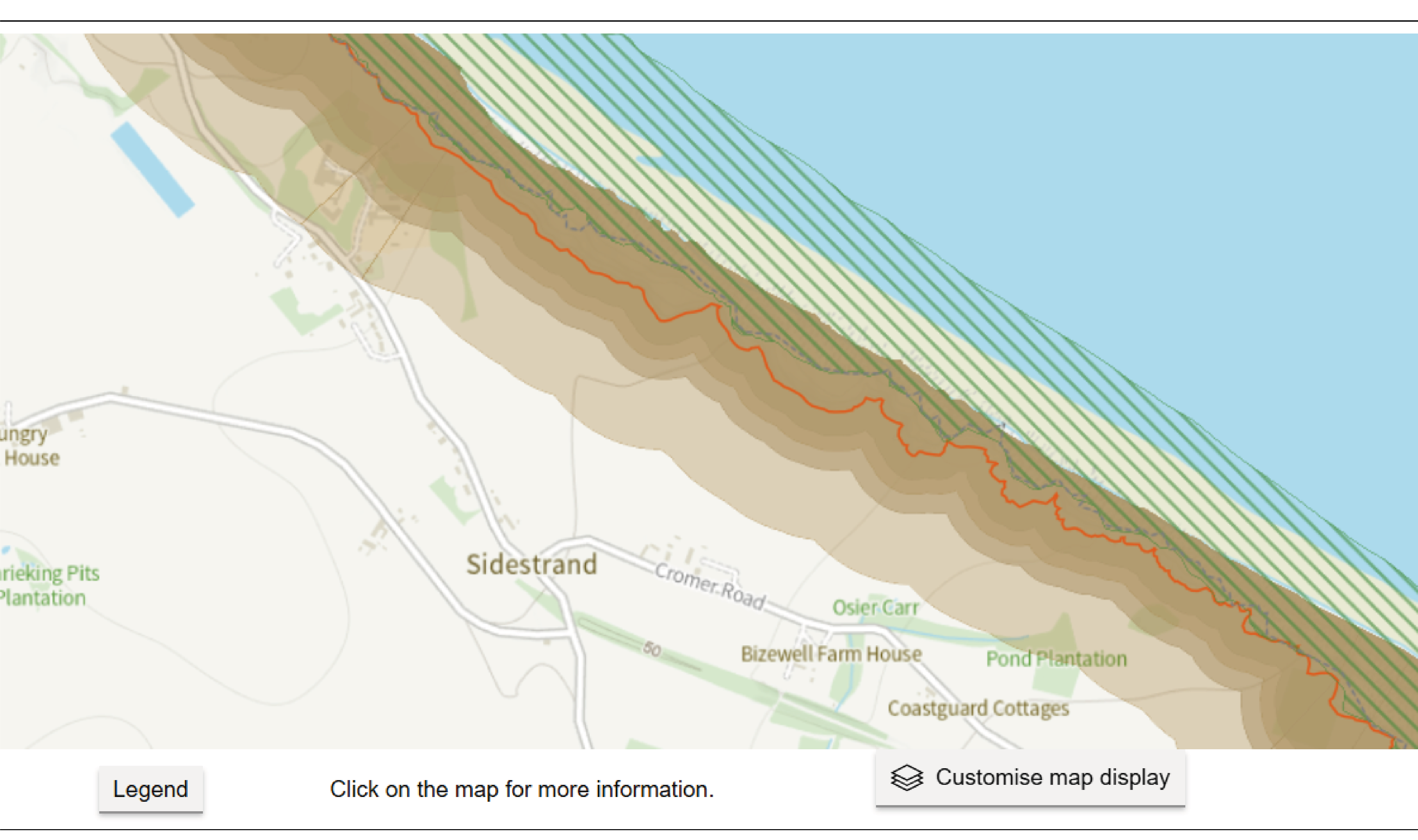
8) You can use the +/- buttons to zoom in to look at the erosion risk in more detail. You can click on the Legend tab to find out what the colours and lines mean.
The example here shows erosion projections for SMP unit 6.12 (Happisburgh), with:
- SMP management approach 20-50 years
- 2055 (darker band) and 2105 (lighter band)
- Sites of Special Scientific Interest
- Erosion Feature Line (most recent data about where the cliff line is)
9) Combining no management intervention with ‘Climate Change (Upper End) for the 2105 epoch will give the most extreme projection.
Here, the selection is for both 2055 and 2105; the map shows these risk bands in different tones – darker for the likely erosion under the selected climate change scenario for 2055 and lighter for 2105.
10) Clicking again on the ‘Customise map display’ button enables you to go back and change the parameters to explore how these lead to different projections of coastal erosion.
Short version
Explore coastal erosion risk
This is the most recent government mapping projection of erosion risk. The data takes into account the most up-to-date coastal modelling and climate change information available.
It sits alongside the Shoreline Management Plan policy information so that you can explore the two things together - Check coastal erosion risk for an area in England - GOV.UK
- Click Start Now
- Enter a place name
- Click on the link to the correct place
- Select the section (policy unit) of the map you are interested in
- This then takes you to the Shoreline Management Plan information for this area, which you can explore in more detail
- To examine erosion risk, click the Customise Map Display tab
- Select the parameters you are interested in (e.g. if there is no intervention, with climate change upper end for the 2105 epoch, this will give you the most extreme projection for erosion)
- Click Save and close – then zoom in on the map to see in more detail what the selected scenarios show
Last updated: 6th July 2026